Russells Needle, Australia
EXCURSION DATE: Jan 2020
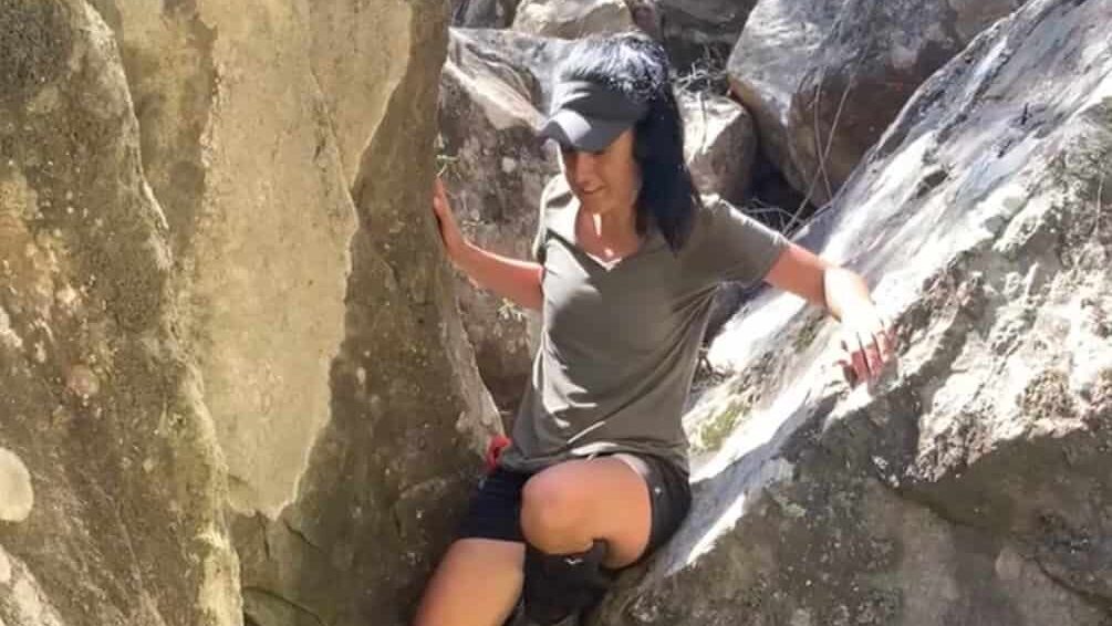
Russells Needle….that was an hard track!!! And I was very glad I wasnt on my own. Infact with me there was Rachel, founder of the Sydney’s Hiking Women Fb group.
….thats an hard track!!! And I was very glad I wasn’t on my own. In fact with me there was Rachel, founder of the Sydney’s Hiking Women Fb group.
You will think…It’s only 21km how can it be so hard?
Day 1 | By the river
Being a loop, we started our descend taking the right hand side and camped by the river at the bottom of the Russell needle. The trail is pretty difficult to navigate and it is pretty easy to get the wrong tracks.
Took us around 1.5h to get to the river from the car park, where we had a dip and lunch. From there we walked along the river was pretty stunning, but be prepared for multiple river crossing… Don’t be silly like me… sometimes is easier to remove your boots instead of falling in water because you try to jump on rocks and logs. I ended up with a wet bump ahha.
Few hours later, and a dry bump (finally) we made it to the bottom of Russell needle, we set camp, left the backpacks and we started our way to the peak…it was 2.5km to the peak, there is no obvious way to get to the top and we opted to scramble over the ridge with a 45m/km pace, so 1km up and we realized it was getting dark and we decided (thankfully) to abort the mission and attempt on the day after.
Sometimes hikers (me included) we think we can achieve peaks and putting ourself in danger.
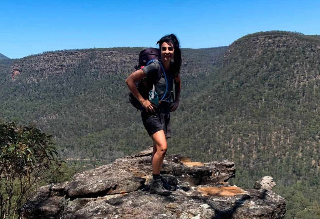
- Where: Russells Needle, Australia
- Multi Day Hike
- Distance:26 km
- Average Duration: overnight (14 hours)
- Difficulty Level: Hard
- Total Elevation Gain: 1063m ish
- Point to Point
- Start/Finish: Car park Nattai Road w11e
Who is this hike for?
I don’t recommend this hike unless you are very good at navigation and quite fit.
Signs
Few to get to the gorge, then none till you get to the ridge and you will find some crains.
Period
All year round
Day 2 | On the top
The morning after we decided after a dip, we started out 3h journey to the top!
This time instead of scrambling the ridge we decided to stick to the river system, and at the end we finally saw some cranes and we knew we finally made it…took us another 30min to reach the summit…where we felt unbeatable!
We scramble and bushbashed our way down to camp, where we packed out and started our way to back. We thought the hardest part was gone, BUT going back up with 15kg on our shoulders and 37degrees took us 3.5hrs to do 4.5km. When we got to the fire trail we were cooked. We coulndt feel our legs feet and shoulders.
The hike is beautiful, but very remote and challenging, I don’t recommend this hike unless you are very good at navigation and quite fit.
And be prepared for a real adventure! Scramble, slip and slides are happening every minute.
Have you done this walk? Please, let me know your thoughts and if I have missed something!
IMPORTANT: Pay close attention to the data contained in this description.
They may be incomplete or outdated. The paths may undergo variations over time due to bad weather, fires or simply the change of seasons. Check in the comments if anyone has made any reports or recommend any changes.
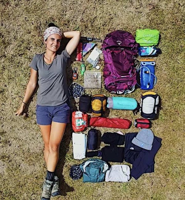
Suggested Gear
- beacon
- GPS
- compass
- map
- trekking poles
- hiking boots
Frequently Asked Questions
Dog allowed?
Yes, You can take your puppy… but only if you collect their 💩!!
Where to sleep? Tent?
- Not many accommodations along the Alta Via, so plan to stay in B&Bs or hotels in coastal villages.
- Book in advance, especially during peak seasons, as demand is high.
- If you stay up on the Alta Via there are plenty of places where you can set up a tent, but bear in mind that you need to think about water and food supplies
Difficulty
It doesn’t present any major challenge, but make sure you are happy with elevation gain
Credentials?
There are no credentials.
Best months to hike it?
- The mild climate makes the Alta Via suitable for year-round hiking, but would avoid July and August. (I did it in August and it was way too hot).
- As usual, check weather forecasts for safety, avoiding the trail during heavy rain or strong winds.
What to bring?
- Wear sturdy, comfortable hiking shoes suitable for various terrains. It is not a walk in the park and is more challenging than expected.
- Carry trekking poles for stability.
Trail waymarking
- Marked trail with signage, but it could be improved.
- Especially if you don’t speak Italian, I would recommend having a gpx map with you.
Planning Information
Cinque Terre and sourroundigs areas can get packed and fully booked quite in advance. So make sure you book your stays and plan the whole hike in advance.
Getting there & Away
Few options:
- I recommend starting in Levanto, which is accessible by train from La Spezia or Milan. Trains are the most practical mode of transportation between Cinque Terre villages.
- If you want to start from Porto Venere, then you need to get a bus 11/P from La Spezia
- If you travel by car consider leaving your car in Campiglia, a village midway between Portovenere and Telegrafo and then getting to the beginning of the trail (hitchhiking, hiking, booking a taxi in advance…)
Permits & Fees
No Permits required.
IMPORTANT: Pay close attention to the data contained in this description.
They may be incomplete or outdated. The paths may change over time due to bad weather, fires or simply the change of seasons. Check in the comments if anyone has made any reports or recommended any changes.
Do you still have a question?
"Discover Italy Like a Local" Consultation
I always try to write everything I can to give the best possible informations, but if you feel like you need a specific and tailored consultation, feel free to book a one-on-one consultation to address your concerns, answer your questions, and provide support throughout the planning process.❤️

