Corno alle Scale, Emilia Romagna, Italy
Looking for a wild and unforgettable 2-day hike in the Italian Apennines?
The Corno alle Scale hike is one of the most spectacular trekking experiences in Emilia-Romagna, combining mountain ridges, alpine lakes, and dramatic cliffs.
In this route, you’ll climb some to the highest peak in the Bolognese Apennines, sleep near a mountaintop lake, and walk along the thrilling edge of Balzi dell’Ora—a panoramic cliffside path. Here’s your detailed guide to this two-day circular hike, ideal for hikers looking for a weekend escape from Bologna, Florence, or Modena.
Though less celebrated than the Aosta Valley and the Dolomites, the Apennines provide breathtaking views and a sense of remoteness that’s rare to find in Italy.
So I definitely encourage you to tackle this hike.
Catch you outside,
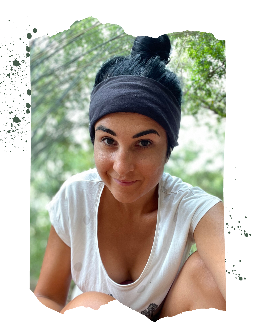
Elena
- Where: Emilia Romagna
- Multi Day Hike
- Distance: 120 km
- Average Duration: 5-6 days
- Difficulty Level: Medium to Hard
- Total Elevation Gain: 7.445m
- Loop
- Start/Finish: Rifugio Segavecchia
Who is this hike for?
This hike is for experienced hikers ONLY! It is marked, but some sections are very exposed and the elevation gain is fair. I recommend having a GPX trace, especially if you don’t speak Italian. As usual, make sure to be well-prepared for any emergency.
Day 1 | Rifugio Segavecchia to Lago Scaffaiolo via Balzi dell’Ora
- Distance: 19km
- Elevation Gain: 1378m
- Average Duration: 6-7h
- Difficulty level: Easy to Medium
- Start/Finish: Berceto to Lago Santo Parmense
Start your hike from Rifugio Segavecchia (1,100 m), where you’ll enter a dense beech forest along trail CAI 129. After about 1.5 hours, you’ll emerge at Passo del Vallone, where the views begin to open up.
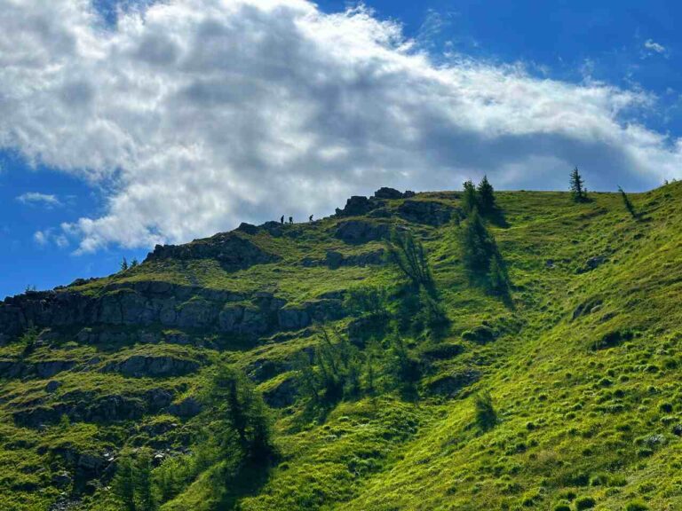
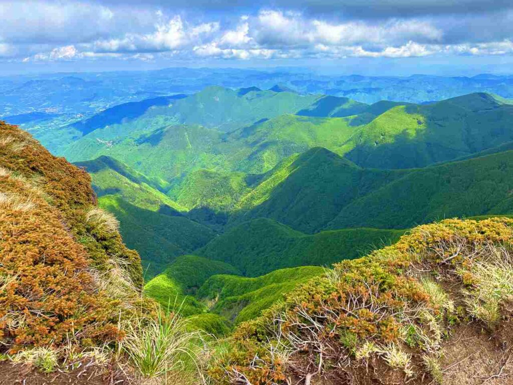
From here, follow signs for Balzi dell’Ora, a stunning but EXPOSED ridge trail that hugs the edge of a steep cliff. The path is safe and well-marked, but not recommended for people with vertigo. Also, pay lots of attention on rainy days. This section offers panoramic views over the valleys of Tuscany and Emilia-Romagna—perfect for photography or just a snack break with a view.
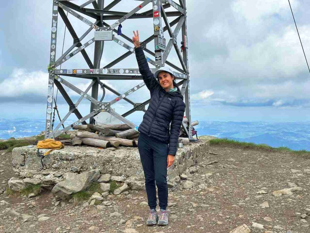
Continue your ascent on trail CAI 00, which leads you to the summit of Corno alle Scale (1,945 m). On a clear day, you can see as far as the Alps to the north and the Tyrrhenian Sea to the west.
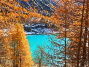
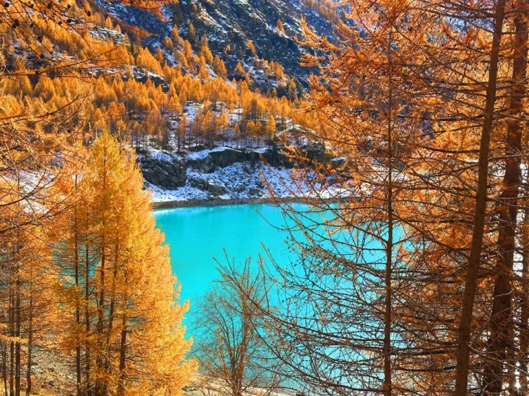
After celebrating your summit, descend to Lago Scaffaiolo—a peaceful glacial lake sitting just below the ridge. Right next to it, you’ll find Rifugio Duca degli Abruzzi, your home for the night.
Day 2 | Lago Scaffaiolo to Rifugio Segavecchia
- Distance: 32km
- Elevation Gain: 2,096m
- Average Duration: 10-11h
- Difficulty level: Hard
- Start/Finish: Lago Santo Parmense - Passo Cerreto
Wake up early to catch the sunrise over Lago Scaffaiolo, a magical moment when the fog often rolls over the mountains like waves.
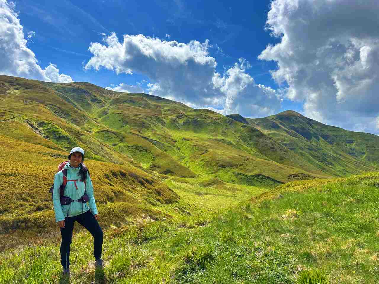
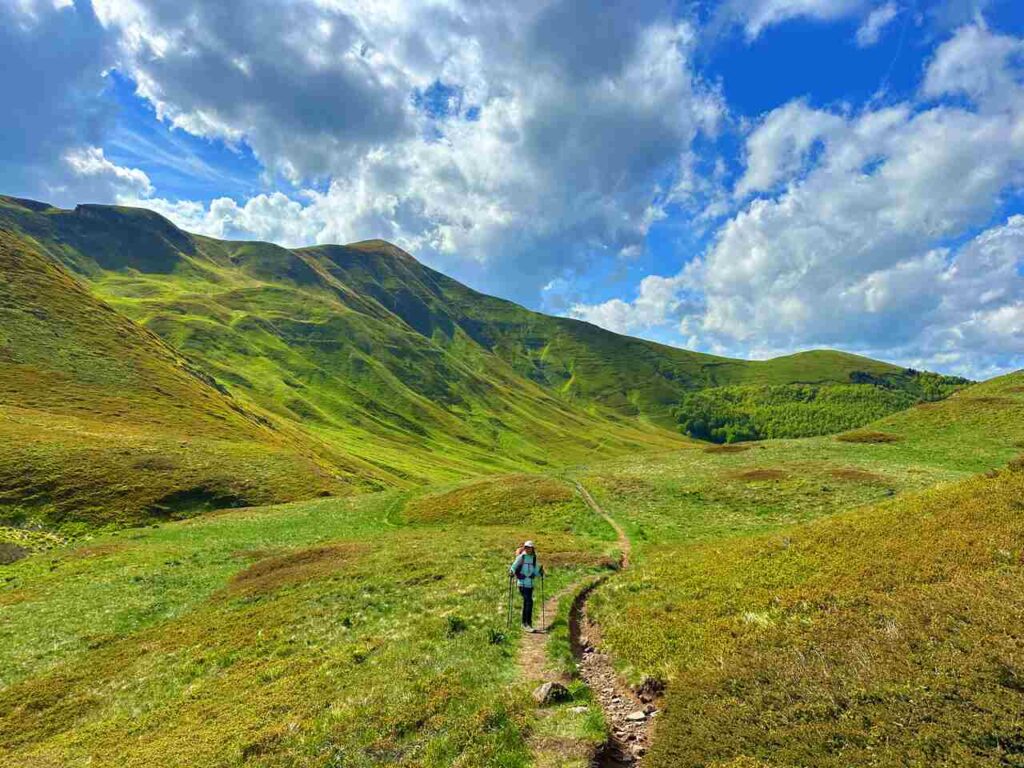
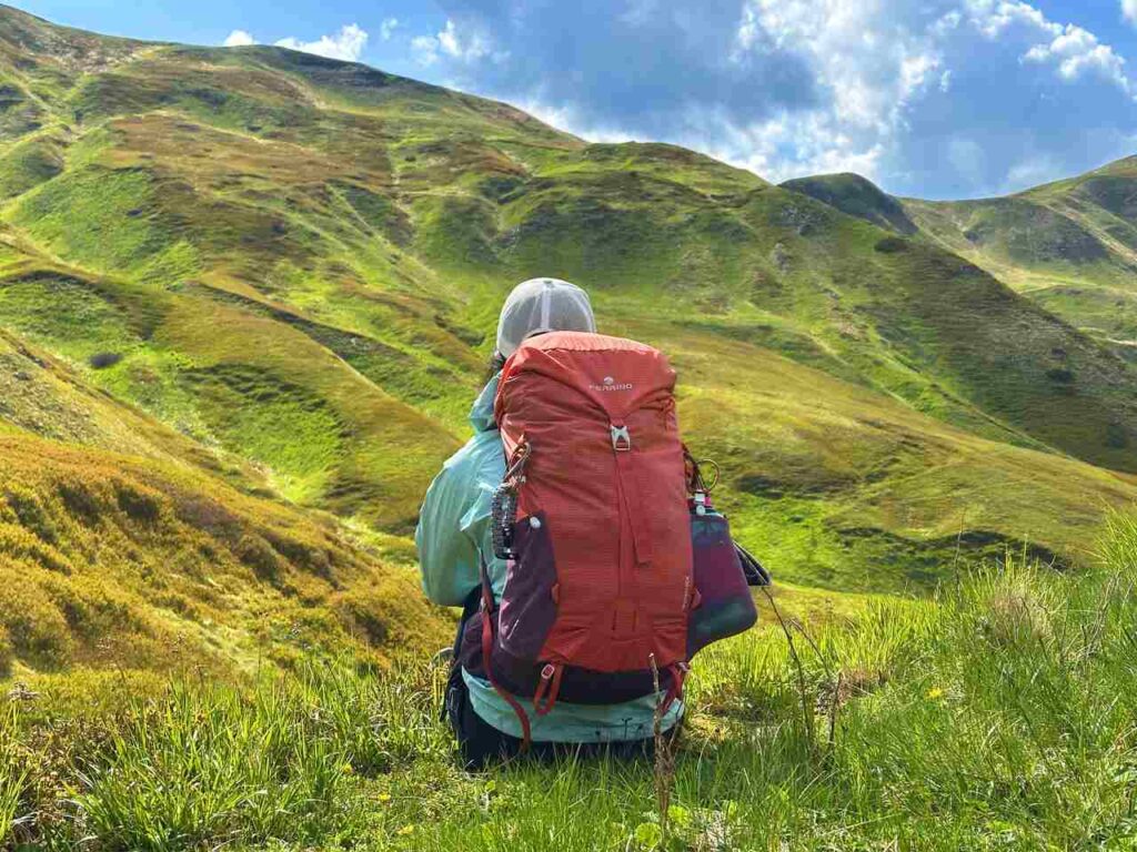
After breakfast, take trail CAI 00 westward along the ridge toward Passo Strofinatoio. This section offers gentle ups and downs with wide views over the Corno alle Scale Regional Park.
From the pass, follow trail CAI 129A to begin your descent into the Valle del Silenzio—a quiet and remote section of the park with soft trails, streams, and shady woods.
You’ll eventually reconnect with trail CAI 129, closing the loop and returning to your starting point at Rifugio Segavecchia.
This 2-day hike is a must-do, offering a blend of challenging hikes and stunning landscapes. If you’re looking for a hike that takes you off the beaten path and deep into Italy’s natural beauty, this trail is a must.
👇🏻Feel free to book a “Discover Italy like a Local” with me 👇🏻
Catch You Outside,
Elena
Frequently Asked Questions
Can I do it in one day?
Absolutely, but it is a very long day so start early in the morning.
Dog allowed?
Yes, You can take your puppy… but only if you collect their 💩!!
Where to sleep? Tent?
You can do it by tent, always allowed near the Hut and Lake Scaffaiolo. You can bivouac from sunset to sunrise.
You can also stay at Rifugio Duca degli Abruzzi, but make 100% sure it is open.
Difficulty
Some sections are EE (experienced hikers). Lots of elevation gains, windy on top of the ridge.
Credentials?
There are no credentials.
Best months to hike it?
- Spring to Autumn.
- As usual, check weather forecasts for safety, avoiding the trail during heavy rain or strong winds.
What to bring?
- Wear sturdy, comfortable hiking shoes suitable for various terrains. It is not a walk in the park and is more challenging than expected.
- Carry trekking poles for stability.
Trail waymarking
- Marked trail with signage, but it could be improved.
- Especially if you don’t speak Italian, I would recommend having a gpx map with you.
Planning Information
Many huts are closed during mid-season, or they open only during the weekends.
Getting there & Away
🚗 By Car
From Bologna: ~1 hour 45 minutes
From Florence: ~2 hours
Set GPS for Rifugio Segavecchia or La Ca’, Lizzano in Belvedere (BO)
Free parking available near trailheads
🚌 By Public Transport (Limited)
Take a train to Porretta Terme, then a local bus to Lizzano in Belvedere or La Ca’
Bus schedules are limited—check TPER
Consider a taxi from Porretta if timing is tight
Permits & Fees
No Permits required.
IMPORTANT: Pay close attention to the data contained in this description.
They may be incomplete or outdated. The paths may change over time due to bad weather, fires or simply the change of seasons. Check in the comments if anyone has made any reports or recommended any changes.
Do you still have a question?
"Discover Italy Like a Local" Consultation
I always try to write everything I can to give the best possible informations, but if you feel like you need a specific and tailored consultation, feel free to book a one-on-one consultation to address your concerns, answer your questions, and provide support throughout the planning process.❤️