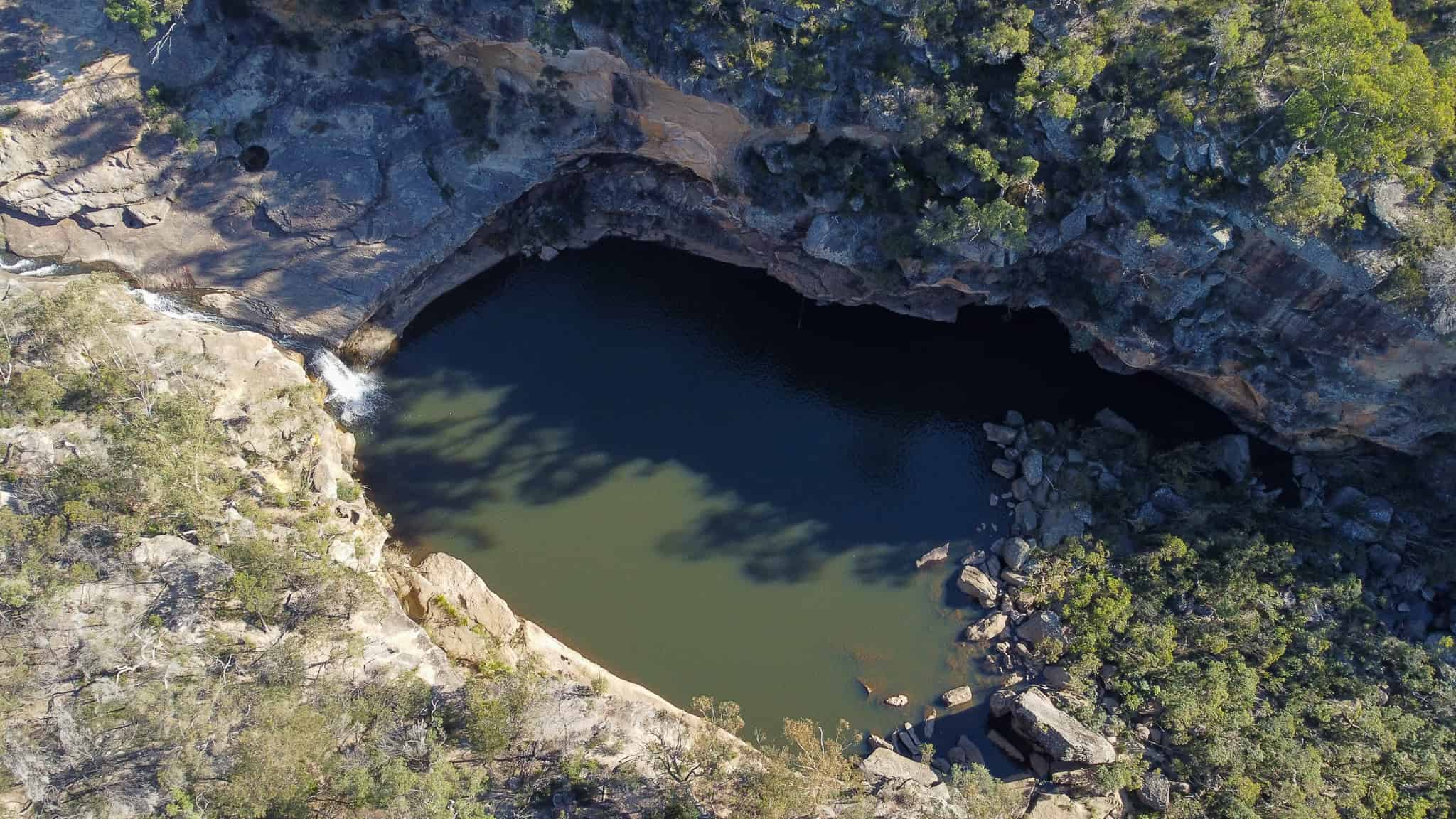
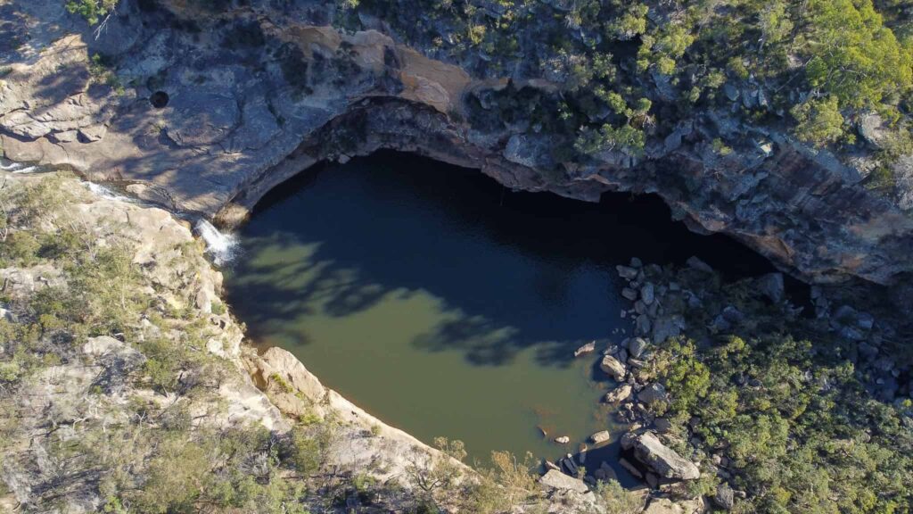
Mermaid Pools, NSW
EXCURSION DATE: April 2020
The Wollondilly region is situated at the south-western fringe of the Sydney metropolitan area, about 1,5h from the Sydney CBD.
This area offers a range of hikes with stunning views to appeal to the taste of solo hikers, family and couples.
In April, I spent 3 days in Lakesland, in a beautiful cabin surrounded by nature to recharge my batteries.
With only a few days in the area, I took the long weekend to relax and cook on the campfire, but I have also gone to check the Mermaid Pools, which a dear friend of mine recommended.
If you are thinking to explore Mermaid Pools, then this article can be of help.
Ready? Let’s begin!
If you are like me and you love chasing waterfalls and natural pools, this is definitely the hike for you.
Signs
Marked reasonably well, only a lil bit of scrambling (only did Mermaid pool)
Period
All year round
- Elevation Gain: 100m ish
- Lenght: 4km
- Difficulty: easy/moderate
- Time: overnight (14hours)
How to get there
It took me few rounds to understand where the parking was, as I didn’t do a proper search before heading there. So, I will save you some time… just add these coordinates to the parking lot.
Once you get there, on your right you will see a bridge, head in that direction and you will start to see all the trail signs to get to the mermaid pools
However, I recommend that you have at least some experience hiking beforehand especially if you will opt to walk the canyon. Reaching the base of the canyon can be a bit hard to access and having experience allows for a better judgement of what is and isn’t a safe thing within the canyon and help you avoid dangerous situations.
Wait a sec! If you have found this article, searching on the net. I want to introduce myself!
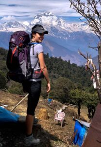
I’m Elena! Ciao! I’m a solo hiker and adventure seeker. I love hiking and cooking. Always on the hunt for a new peak to reach and a recipe to fill my belly on top of the mountain while staring at stunning views.
The walking trail
You can either reach the mermaid pools (4km) or add a lil loop around the Tahmoor Gorge (9km). Phone reception is spotty, remember to always carry your beacon. Here, few suggestions. If you don’t hike often, you can rent it.
Read here, to find where you can rent it.
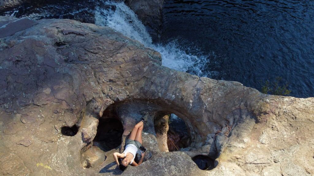
Swimming is highly discouraged. Entering in a mermaid pool is at your own risk because of the high chance of falling on the rocks below, the hidden rocks below the water surface of the water and the only way to get out is through an old rope and it will be very hard to climb out. Many people have been injured or lost their lives because they have misread the situation
Along the way, there are a lot of other safer options to swim and many ropes to swing into the water.
Just remember that there are no toilets, drinking water or rubbish bins. So please be make sure to pack everything you need. If you have a life straw or any water filtration system there is no need to carry a lot of water.
the only trail markers are made by pink, orange and blue ribbons or white and yellow rocks marking so keep an eye on them. They are very frequent so it will be very hard to get lost, but still possible if you don’t pay enough attention.
I was there on a Monday, it was magical and I was literally the only one around, but for the small amount of rubbish I have found along the trail, I reckon not many people know this lil gem. So PLEASE PLEASE if you are planning to hike here be respectful.
History
According to my research, Mermaid Pools is a sacred site (women’s birthing place) for the local Aboriginal community – the Tharawal people, and it is believed to be protected by spirits. Also, Aboriginal men are not allowed to visit. So, an additional point on why you shouldn’t swim in the pool and be extremely respectful.
In conclusion, if you are seeking contact with nature, hate crowds and want to live a unique experience. If you like the idea of sleeping under the stars and drinking a glass of wine around the fire, but not the idea of wild camping: pitch a tent, fill the trunk of the car, sleep on damp ground and have cold showers (in the river!)…or if you just start exploring a wilder type of weekends… this is a place to GO!
Have you done this walk? Please, let me know your thoughts and if I have missed something!
Suggested gear
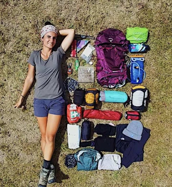
- beacon
- water / water filtration system
- hiking boots/shoes
Frequently Asked Questions
Dog allowed?
Yes, You can take your puppy… but only if you collect their 💩!!
Where to sleep? Tent?
- Not many accommodations along the Alta Via, so plan to stay in B&Bs or hotels in coastal villages.
- Book in advance, especially during peak seasons, as demand is high.
- If you stay up on the Alta Via there are plenty of places where you can set up a tent, but bear in mind that you need to think about water and food supplies
Difficulty
It doesn’t present any major challenge, but make sure you are happy with elevation gain
Credentials?
There are no credentials.
Best months to hike it?
- The mild climate makes the Alta Via suitable for year-round hiking, but would avoid July and August. (I did it in August and it was way too hot).
- As usual, check weather forecasts for safety, avoiding the trail during heavy rain or strong winds.
What to bring?
- Wear sturdy, comfortable hiking shoes suitable for various terrains. It is not a walk in the park and is more challenging than expected.
- Carry trekking poles for stability.
Trail waymarking
- Marked trail with signage, but it could be improved.
- Especially if you don’t speak Italian, I would recommend having a gpx map with you.
Planning Information
Cinque Terre and sourroundigs areas can get packed and fully booked quite in advance. So make sure you book your stays and plan the whole hike in advance.
Getting there & Away
Few options:
- I recommend starting in Levanto, which is accessible by train from La Spezia or Milan. Trains are the most practical mode of transportation between Cinque Terre villages.
- If you want to start from Porto Venere, then you need to get a bus 11/P from La Spezia
- If you travel by car consider leaving your car in Campiglia, a village midway between Portovenere and Telegrafo and then getting to the beginning of the trail (hitchhiking, hiking, booking a taxi in advance…)
Permits & Fees
No Permits required.
IMPORTANT: Pay close attention to the data contained in this description.
They may be incomplete or outdated. The paths may undergo variations over time due to bad weather, fires or simply the change of seasons. Check in the comments if anyone has made any reports or recommend any changes.
PS: If you have any tips or question about this track please let me know in the comments or DM me in IG!
Do you still have a question?
"Discover Italy Like a Local"
Consultation
I always try to write everything I can to give the best possible informations, but if you feel like you need a specific and tailored consultation, feel free to book a one-on-one consultation to address your concerns, answer your questions, and provide support throughout the planning process.❤️

