Mount Claude, Tasmania
Mount Claude is a small mountain located in the Great Western Tiers mountain range and is often overlooked by tourists due to its relatively low height.
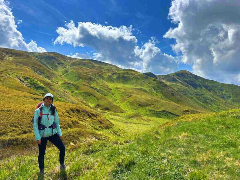
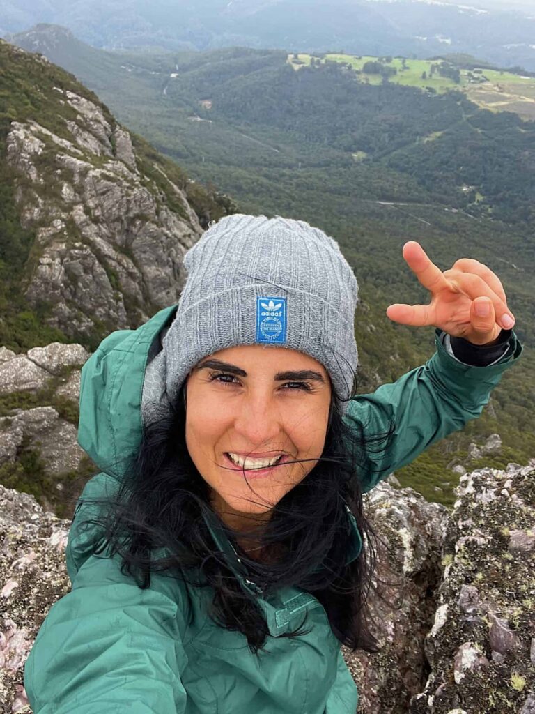
However, despite its small size, Mount Claude offers some of the most stunning views in Tasmania. From its summit, you can enjoy breathtaking panoramic views of the surrounding landscapes, including rolling hills, dense forests, and the distant peaks of the Great Western Tiers mountain range.
- Where: Tasmania
- Abel :5/158
- Day hike
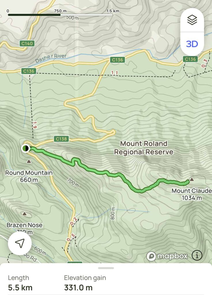
- Distance: 5.5 km
- Average Duration: 3h
- Difficulty level: Medium, hard to summit
- Total elevation Gain: 330m
- Out and Back
- Start/Finish: Round Mountain Lookout

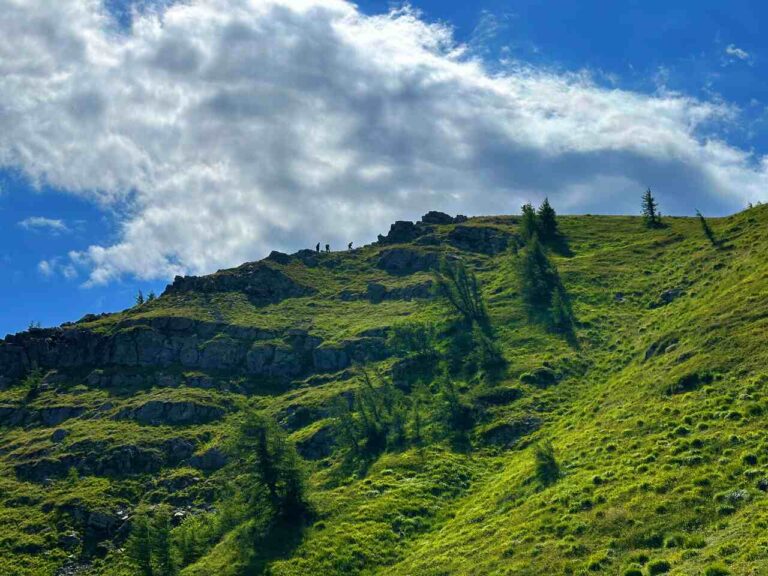
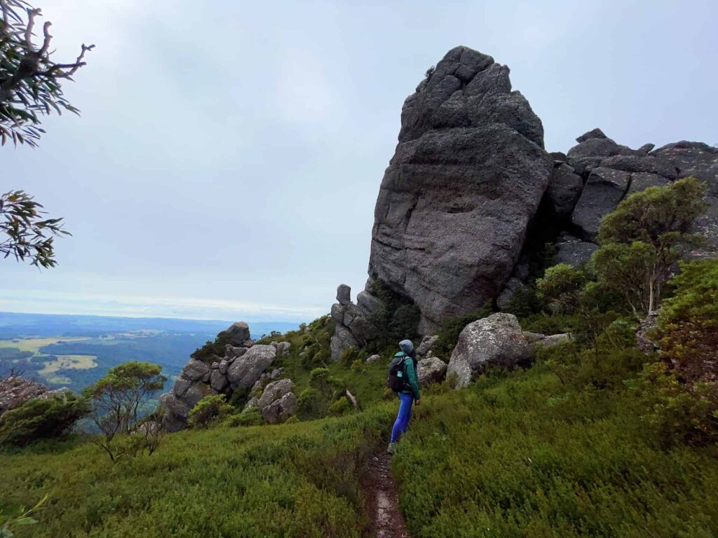
The track on Mount Claude
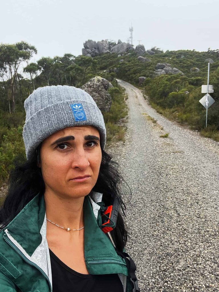
To reach Mount Claude it is a leisurely hike, but if you decide to reach the peak it will be a demanding hike. Infact, the hike to the top of the mountain is relatively easy and takes around 2 hours to complete. The trail starts at the car park located near the base of the mountain and follows a well-defined path, the first 1.5km is a service road, then you will hit the trail and you will encounter a variety of vegetation, including eucalyptus trees, ferns, and moss-covered rocks.
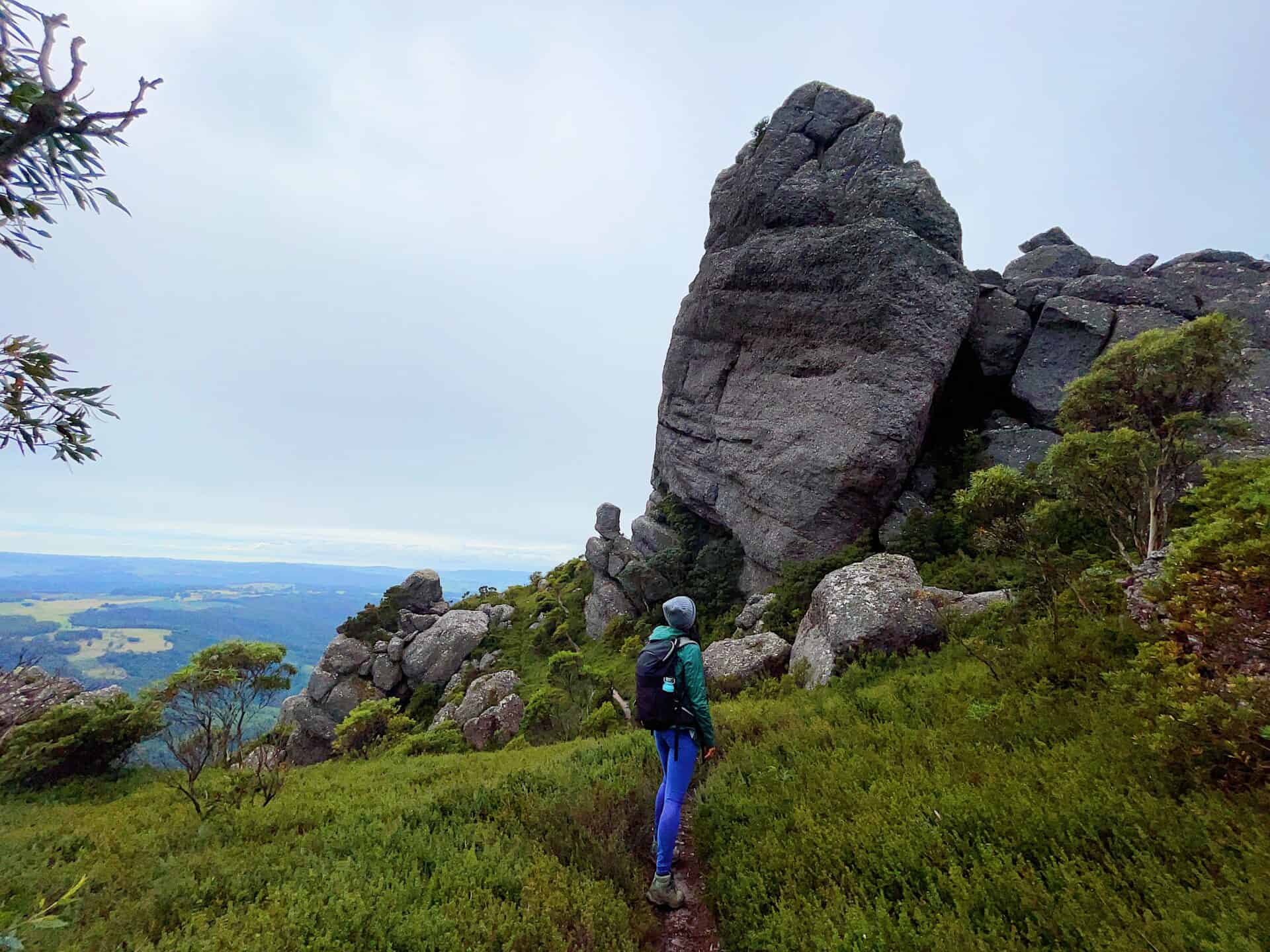
Once at the summit, you will be rewarded with stunning views of the surrounding landscape. On a clear day, the views extend for miles in every direction and offer a glimpse into the beauty of Tasmania’s wilderness.
In addition to the stunning views and natural beauty, Mount Claude is also steeped in history. The mountain was named after the French explorer Claude de la Vale, who was one of the first Europeans to explore the area in the late 1700s. The area around Mount Claude was also home to the Tasmanian Aborigines for thousands of years, and visitors can still see evidence of their presence in the form of rock art and middens.
Getting to
Drive to the Great Western Tiers: Mount Claude is located in the Great Western Tiers mountain range, which is located in central Tasmania. The drive from Launceston or Hobart to the Great Western Tiers will take around 2-3 hours depending on your starting point.
Find the trailhead: once you have arrived in the Great Western Tiers area, you will need to find the trailhead for the Mount Claude hike. The trailhead is located in the Central Highlands Conservation Area and is well-marked with signs.

Recommendations
It is important to note that Mount Claude is located within the Tasmanian Wilderness World Heritage Area and it is important to respect the natural environment by leaving no trace and following all rules and regulations. Before embarking on your hike, be sure to check the weather conditions and trail conditions, and plan accordingly.
Recommended to do it on a clear day as you won’t be disappointed. The reward at the top are stunning 360* views.

Frequently Asked Questions
Dog allowed?
Yes, You can take your puppy… but only if you collect their 💩!!
Where to sleep? Tent?
- Not many accommodations along the Alta Via, so plan to stay in B&Bs or hotels in coastal villages.
- Book in advance, especially during peak seasons, as demand is high.
- If you stay up on the Alta Via there are plenty of places where you can set up a tent, but bear in mind that you need to think about water and food supplies
Difficulty
It doesn’t present any major challenge, but make sure you are happy with elevation gain
Credentials?
There are no credentials.
Best months to hike it?
- The mild climate makes the Alta Via suitable for year-round hiking, but would avoid July and August. (I did it in August and it was way too hot).
- As usual, check weather forecasts for safety, avoiding the trail during heavy rain or strong winds.
What to bring?
- Wear sturdy, comfortable hiking shoes suitable for various terrains. It is not a walk in the park and is more challenging than expected.
- Carry trekking poles for stability.
Trail waymarking
- Marked trail with signage, but it could be improved.
- Especially if you don’t speak Italian, I would recommend having a gpx map with you.
Planning Information
Cinque Terre and sourroundigs areas can get packed and fully booked quite in advance. So make sure you book your stays and plan the whole hike in advance.
Getting there & Away
Few options:
- I recommend starting in Levanto, which is accessible by train from La Spezia or Milan. Trains are the most practical mode of transportation between Cinque Terre villages.
- If you want to start from Porto Venere, then you need to get a bus 11/P from La Spezia
- If you travel by car consider leaving your car in Campiglia, a village midway between Portovenere and Telegrafo and then getting to the beginning of the trail (hitchhiking, hiking, booking a taxi in advance…)
Permits & Fees
No Permits required.
IMPORTANT: Pay close attention to the data contained in this description.
They may be incomplete or outdated. The paths may undergo variations over time due to bad weather, fires or simply the change of seasons. Check in the comments if anyone has made any reports or recommend any changes.
PS: If you have any tips or question about this track please let me know in the comments or DM me in IG!
Do you still have a question?
"Discover Italy Like a Local"
Consultation
I always try to write everything I can to give the best possible informations, but if you feel like you need a specific and tailored consultation, feel free to book a one-on-one consultation to address your concerns, answer your questions, and provide support throughout the planning process.❤️