The Way of Saint Benedict, Umbria and Lazio, Italy
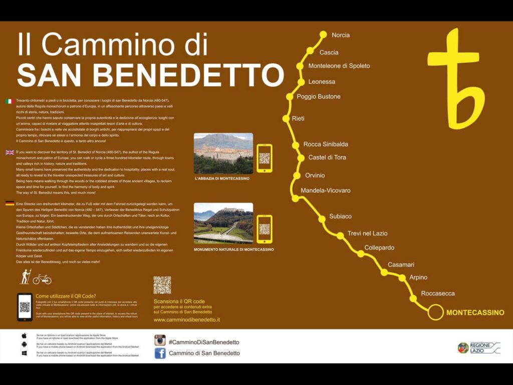
The San Benedetto Trail is a 300-kilometer route from Norcia to Montecassino, passing through Subiaco and spanning two regions (Umbria and Lazio). Dedicated to Saint Benedict of Norcia, the founder of Western monasticism and patron saint of Europe, it offers pilgrims a unique spiritual and experiential journey. Along the way, it highlights some of the most fascinating Benedictine sites in Europe, as well as places of art and stunning landscapes, allowing travelers to discover an authentic Italy rich in traditions, hospitality, and excellent cuisine.
The trail can be completed on foot or by bicycle, either in one go (recommended) or in stages, with public transport available for connections between key stops like Norcia, Rieti, Mandela, and Subiaco.
So I definitely encourage you to tackle this hike.
Catch you outside,
Elena
- Where: Umbria and Lazio
- Multi Day Hike
- Distance: 300 km
- Average Duration: 16 days
- Difficulty Level: Medium to Hard
- Total Elevation Gain: 7.190m
- Point to Point
- Start/Finish: Norcia to Montecassino
Who is this hike for?
The San Benedetto Trail is for everyone: while it runs through mountainous areas with occasional significant elevation changes, the many accommodation options allow you to break up the stages as you see fit. The trail is well-marked with vertical signage, and at every stop, a “Trail Angel” is available to welcome you and meet your needs.
Day 1 | Norcia to Cascia
- Distance: 17.3km
- Elevation Gain: 480m
- Average Duration: 6h
- Difficulty level: Easy
- Start/Finish: Norcia to Cascia
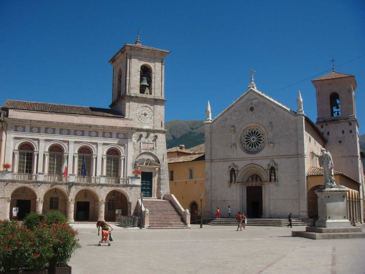
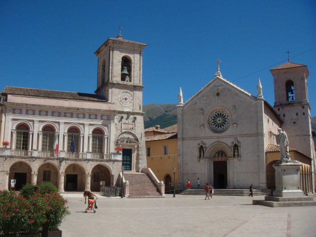
The first stage of the trail goes from Norcia, the birthplace of Saint Benedict, to Cascia, the town of Saint Rita. Norcia lies at the foot of the Sibillini Mountains and boasts a charming historic center (sadly heavily damaged by the 2016 earthquake), sweeping panoramas, fresh air, and a rich culinary tradition ranging from cured meats to dishes featuring mushrooms and truffles. In Piazza San Benedetto stands the basilica of the same name, where the Gothic façade was preserved, along with a statue of Saint Benedict, which seems to point the way forward.
The first stretch crosses the Santa Scolastica plateau before climbing over a pass and descending into Cascia. Here, visitors can explore the monastery and Basilica of Saint Rita, a pilgrimage site that draws countless devotees, especially around May 22, the feast day of the saint. During this time, thousands of pilgrims from around the world fill the town’s streets to honor the “Saint of the Impossible,” as she is known by the faithful who believe in her ability to resolve even the most challenging situations.
Day 2 | Cascia to Monteloene di Spoleto
- Distance: 17.9km
- Elevation Gain: 460m
- Average Duration: 6h
- Difficulty level: Easy
- Start/Finish: Cascia to Monteleone di spoleto
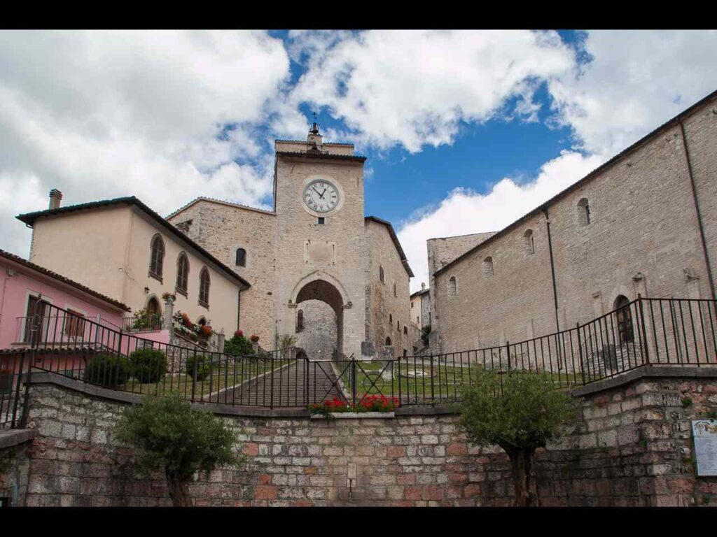
Leaving Cascia, the trail follows the Santa Rita path, a spectacular route carved into the rock high above the Corno River, leading to Roccaporena, the birthplace of Saint Rita in 1381. The devotional journey begins at the saint’s childhood home and continues up the 300 steps to the Sacred Rock (*Sacro Scoglio*), a rocky outcrop where Rita would retreat to pray with such devotion that the impressions of her knees and elbows are said to remain in the stone.
The trail then winds through woodlands to the medieval village of Monteleone di Spoleto, perched at an altitude of 1,000 meters. This picturesque hamlet, crowned by a castle and surrounded by pristine nature, is home to a replica of the famed *Biga di Monteleone*, a 6th-century BCE ceremonial chariot. The chariot, discovered in 1902 in a burial mound at Colle del Capitano, was found in exceptional condition but was swiftly taken and transported to the United States, where it has been displayed at the Metropolitan Museum of Art in New York since 1903.
Day 3 | Monteleone di Spoleto to Leonessa
- Distance: 13.1km
- Elevation Gain: 200m
- Average Duration: 4h
- Difficulty level: Easy
- Start/Finish: Monteleone di Spoleto to Leonessa
Day 4 | Leonessa to Poggio Bustone
- Distance: 14.1km
- Elevation Gain: 550m
- Average Duration: 6h
- Difficulty level: Medium to Hard
- Start/Finish: from Leonessa to Poggio Bustone
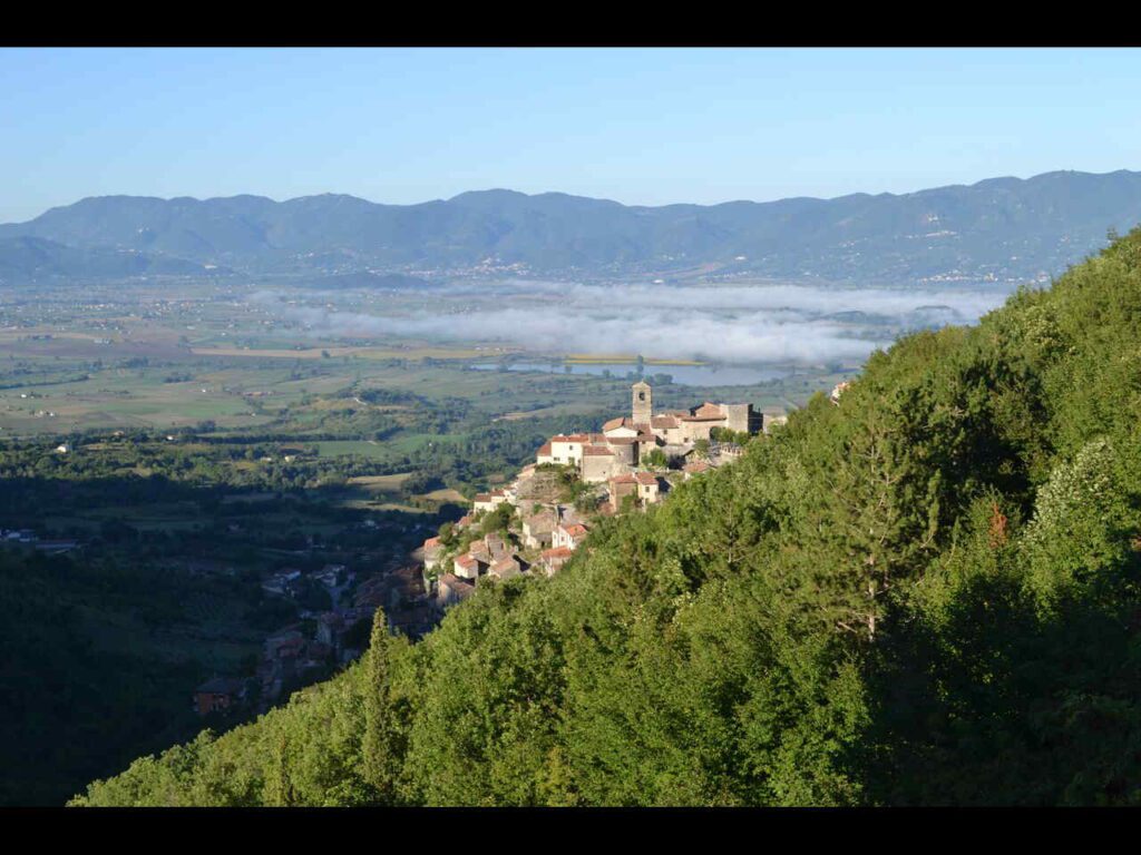
In today’s stage, we reach the highest point of the Cammino at 1,500 m above sea level, crossing the Reatini Mountains from Leonessa to Poggio Bustone, among vast beech forests and wide panoramic views. Among the unmissable sights are the Prati di San Bartolomeo, a wide clearing where an ancient oratory once stood; animals are usually grazing here. At the pass, there is a stone monument that until 1861 marked the border between the Kingdom of Naples and the Papal States; just below is the Petrinara spring, the only water source on this stage. Poggio Bustone is the birthplace of singer Lucio Battisti (a very famous Italian singer, I love his songs so definitely recommend listening to google it), and here stands the Convent of San Giacomo, built on the caves where St. Francis of Assisi spent many hours in prayer. From there, a short walk leads to the Sacro Speco, the “cave of revelations,” where Francis received forgiveness for his youthful sins from God; the view from there makes the effort of the climb worthwhile.
Day 5 | Poggio Bustone to Rieti
- Distance: 17.4km
- Elevation Gain: 200m
- Average Duration: 6h
- Difficulty level: Easy
- Start/Finish: Poggio Bustone to Rieti
In this stage, we cross the Santa Reatina Valley, with splendid panoramic views, heading towards Rieti, the capital of Sabina. The route passes through Cantalice, known for the verticality of its village, and the small sanctuary of San Felice all’acqua, where it is said that Saint Felice of Cantalice, the first saint of the Capuchin Order, made water spring from a rock to quench the thirst of shepherds and farmers. After passing the Sanctuary of the Forest, where St. Francis of Assisi withdrew to await eye surgery, we reach Rieti, an ancient city that preserves monuments from the Roman era such as the bridge over the Velino River and an underground section of the ancient Via Cassia; and medieval buildings, including the Cathedral of Santa Maria Assunta, where St. Francis also prayed during his travels in the Santa Valley.
Day 6 | Rieti to Rocca Sinibalda
- Distance: 20.2km
- Elevation Gain: 450m
- Average Duration: 6h
- Difficulty level: Medium
- Start/Finish: Rieti to Rocca Sinibalda
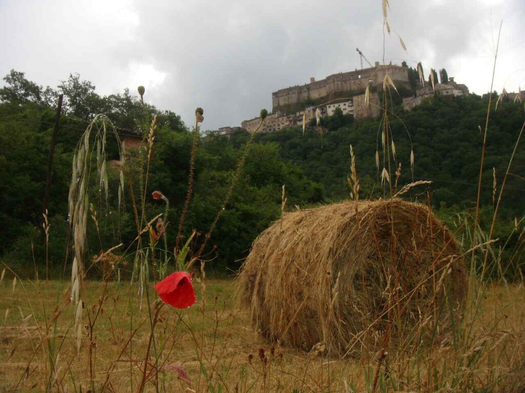
From Rieti, we follow a section of the Via Salaria, then alongside the Turano River, which we follow until reaching the base of the demanding climb to Belmonte in Sabina, a tiny village on a ridge overlooking two valleys. We continue along a panoramic route with a gentle descent, leading us to Rocca Sinibalda, dominated by an imposing castle in the shape of an eagle, dating back to 1084 and later modified. From 1200 to 1500, it was owned by the Mareri family, and here Filippa Mareri, the first Franciscan saint, was born.
Day 7 | Rocca Sinibalda to Castel di Tora
- Distance: 15km
- Elevation Gain: 300m
- Average Duration: 5h
- Difficulty level: Easy
- Start/Finish: Rocca Sinibalda to Castel di Tora
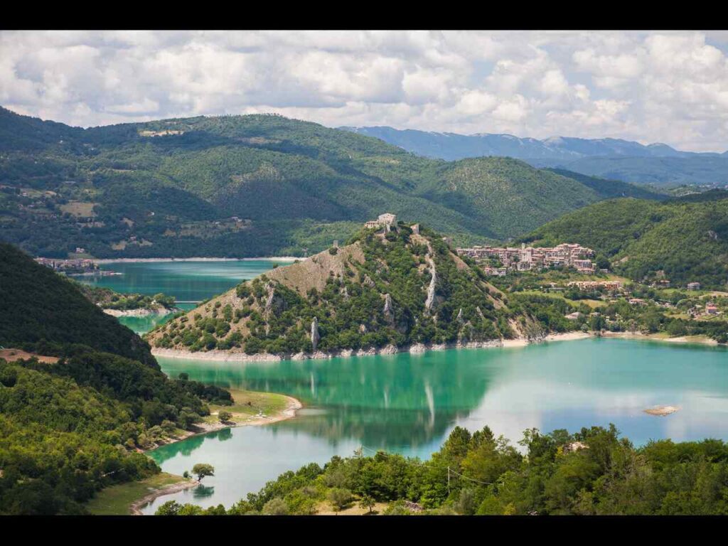
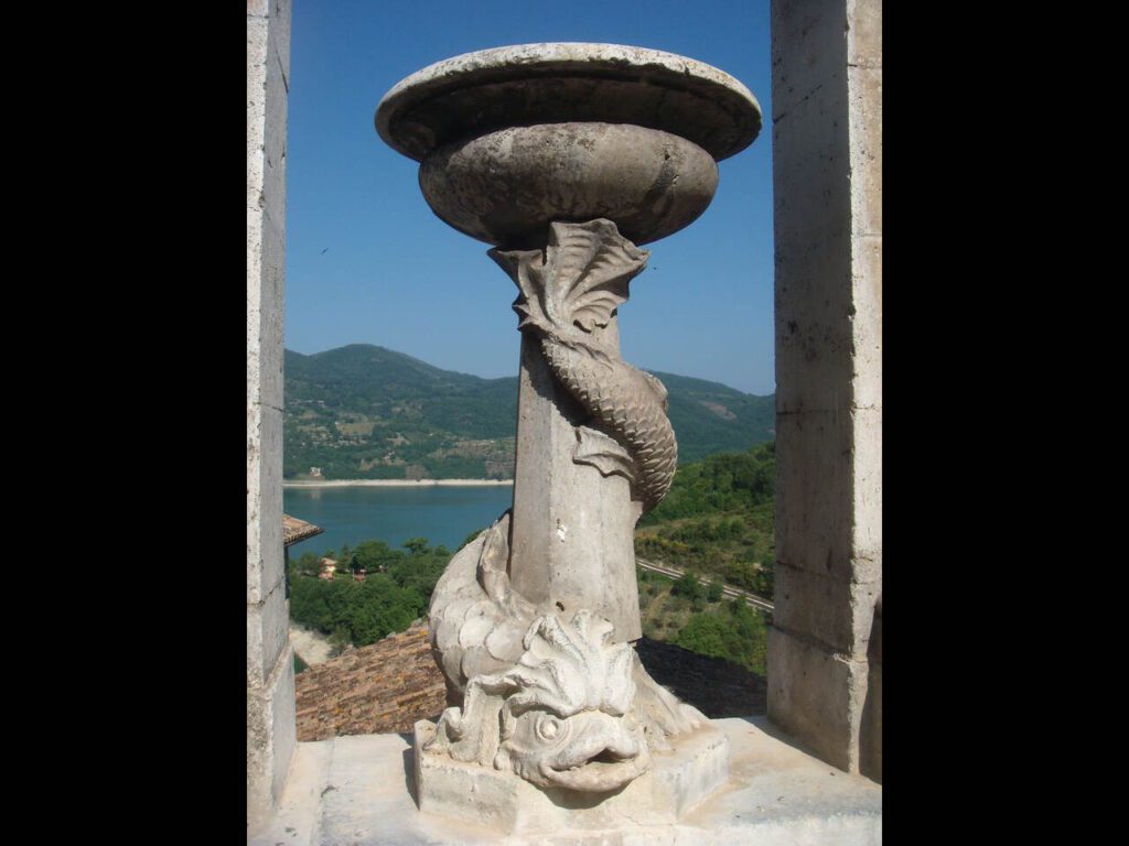
Today’s stage continues through the green valley of the Turano River and reaches the tiny village of Posticciola, where an ancient washhouse and the museum of peasant traditions are located. Just below the village, there is a Roman Bridge; in fact, the current structure is from the 11th century and stands on the remains of an older Roman bridge. After passing a dam, the route follows the Turano Lake for a long stretch, about 10 km, reflecting a beautiful mountainous landscape covered in forests. Castel di Tora is a small village with a typical medieval appearance; the historic center is a maze of narrow alleys and buildings made from local stone, best explored slowly while stopping to admire the magnificent views of the lake. Castel di Tora is part of the club of Italy’s most beautiful villages.
Day 8 | Castel di Tora to Orvinio
- Distance: 13.4km
- Elevation Gain: 750m
- Average Duration: 6-7h
- Difficulty level: Hard
- Start/Finish: Castel di Tora to Orvinio
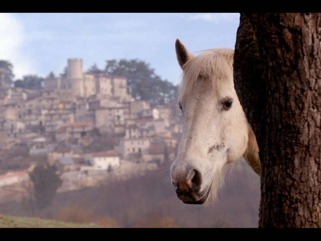
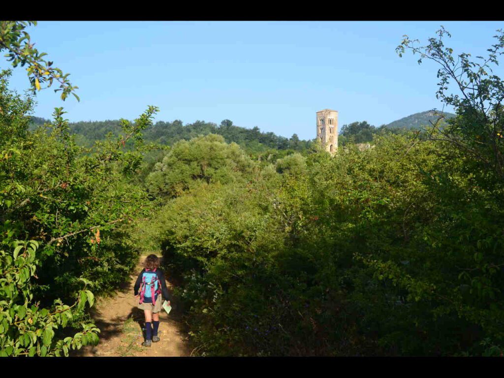
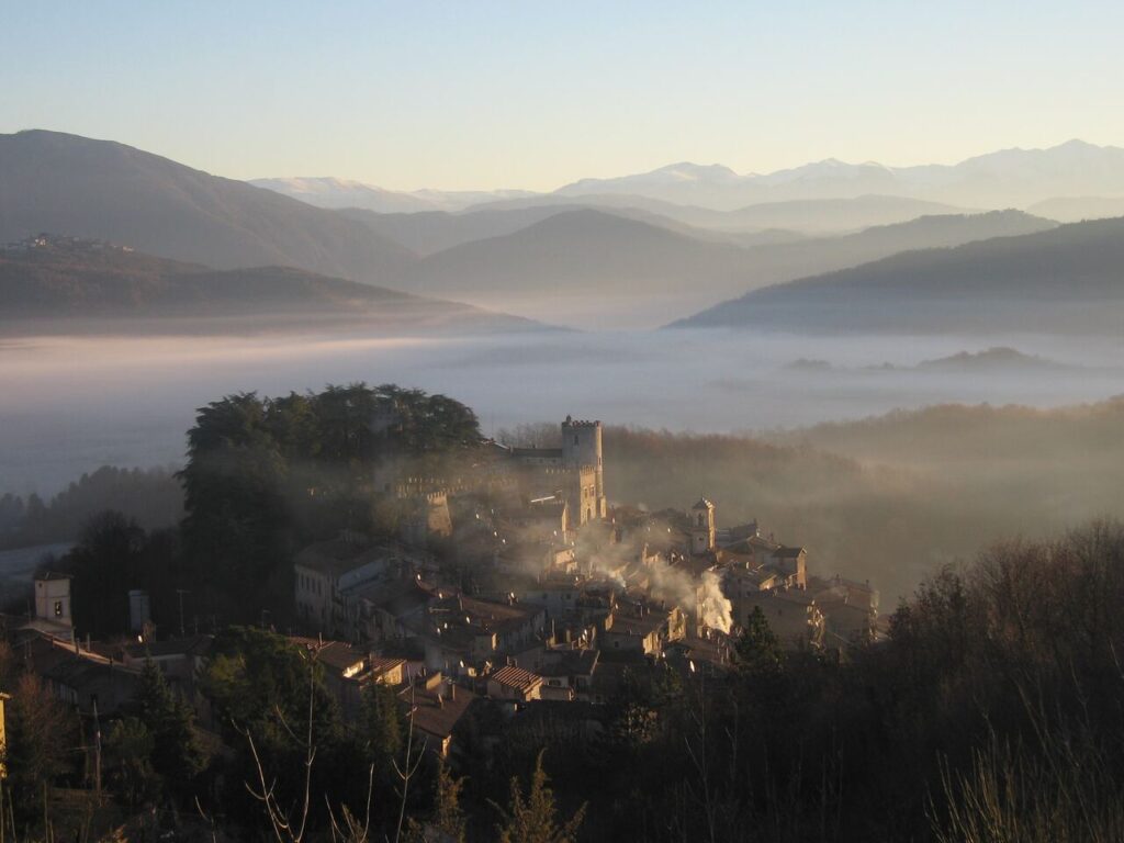
In the first part of the stage, a steep trail offers splendid views of the Turano Lake, surrounded by broom bushes and free-roaming animals, making frequent stops to admire the landscape inevitable. After a brief section through the forest, the trail reaches 1,160 m above sea level. Wide valleys will appear before your eyes, and just below is the mountain village of Pozzaglia Sabina, where Saint Agostina Pietrantoni, patron saint of Italian nurses, was born. In the small village, you can visit the saint’s house and the church where she is buried. Continuing, the route passes through the Piano di Orvinio, a large meadow dominated by the bell tower of the Romanesque Abbey of Santa Maria del Piano, a jewel from the 9th century, whose foundation celebrates Charlemagne’s victory over the Saracens. The destination of the stage is Orvinio, within the Regional Park of the Monti Lucretili. Notable sites include the 16th-century Church of Santa Maria dei Raccomandati and the 1612 octagonal Church of San Giacomo, designed by Gian Lorenzo Bernini.
Day 9 | Orvinio to Mandela/Vicovaro
- Distance: 20.1km
- Elevation Gain: 600m
- Average Duration: 7h
- Difficulty level: Hard
- Start/Finish: Orvinio to Mandela/Vicovaro
Once again, the stage follows mostly trails within the Regional Park of the Monti Lucretili. From Orvinio, the path climbs to the locality of Praterelle; from there, a trail leads upwards through an oak forest to an altitude of 1,100 m. The journey continues to Licenza in a long, moderate descent, through broom bushes and wide panoramas. The town hosts the villa of the poet Horace, one of the greatest figures in Latin literature. The Camino briefly ascends to a ridge overlooking the Aniene River valley; from here, you can admire the nearby Ruffi mountains and the more distant Simbruini mountains. From Pian di Papa, named because it hosted Pope John Paul II several times, you descend to the village of Mandela. You can either stay overnight here or continue to Vicovaro, where the San Cosimato Monastery sits atop a rocky outcrop on a site of Benedictine hermitages and Roman aqueducts, at the narrowest point of the Aniene River valley.
Day 10 | Mandela/Vicovaro to Subiaco
- Distance: 17.4km
- Elevation Gain: 200m
- Average Duration: 6h
- Difficulty level: Medium
- Start/Finish: Mandela/Vicovaro to Subiaco
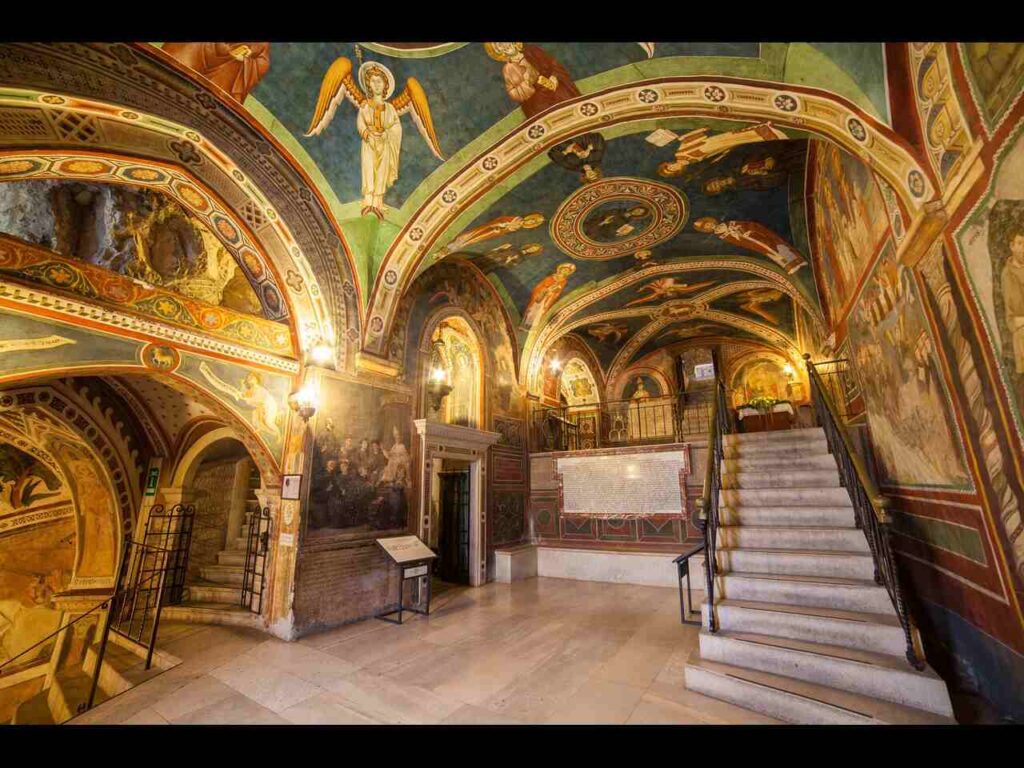
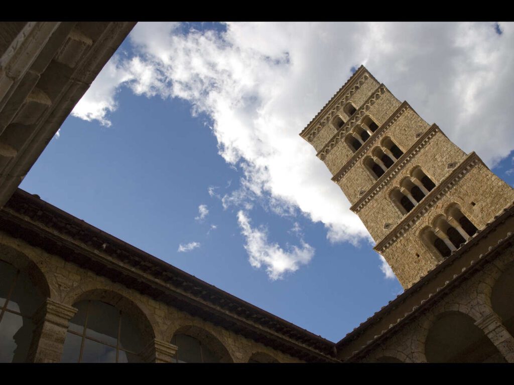
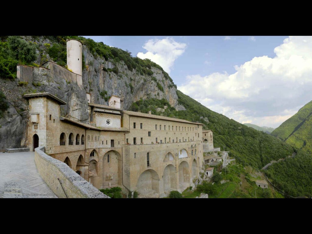
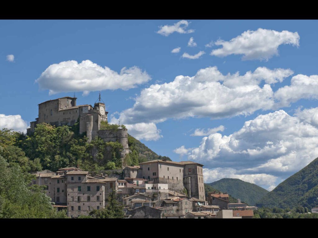
This is a flat stage, entirely on forest paths, following the course of the Aniene River. No towns are passed along the route, but with small detours, you can visit the interesting villages of Anticoli Corrado, Marano Equo, and Agosta. The destination is Subiaco, a key location in the human experience of Saint Benedict. The saint lived here for thirty years: first as a hermit, then as the founder and abbot of small monastic communities. In Subiaco, you will find the Monastery of San Benedetto or Sacro Speco, an extraordinary monastery made up of two superimposed churches built against the vertical wall of Mount Taleo. It was constructed in the 11th century around the original Benedictine hermitage, and in the 14th century, it was covered in paintings depicting stories from the Gospel and the life of Saint Benedict. The Speco, properly speaking, is the cave where Benedict lived for three years in prayer; a staircase leads from there to a small chamber where, on the rock wall, an anonymous artist depicted Saint Francis of Assisi, who visited as a pilgrim in 1224. A little below is the Monastery of Santa Scolastica, built on the first Benedictine settlement and expanded several times. The magnificent Cosmatesque cloister and the bell tower, older than all the bell towers in Rome, are highlights. The library, with 150,000 volumes, was where the first book in Italy was printed in 1465 by students of Gutenberg.
Day 11 | Subiaco to Trevi nel Lazio
- Distance: 17.1km
- Elevation Gain: 430m
- Average Duration: 6h
- Difficulty level: Medium
- Start/Finish: Subiaco to Trevi nel Lazio
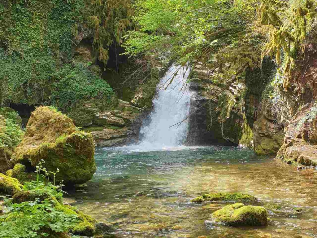
The eleventh stage leads us to Ciociaria, a historic Italian region rich in ancient traditions, good food, and villages full of historical heritage. The route follows a forest road along the Aniene River, inside the Simbruini Mountains Park. Along the way, you will encounter places of enchanting natural beauty, such as the Lake of San Benedetto, nicknamed “The Caribbean of Rome” for its crystal-clear water and proximity to the capital. Then, there is the Trevi Waterfall, one of the ten most beautiful waterfalls in Italy according to the Touring Club Italiano, immersed in the forest at the point where the Anio Novus, Rome’s largest aqueduct, originated during Roman times. Finally, the stage reaches Trevi nel Lazio, an ancient town that enjoyed great prestige during Roman times due to its abundant water resources, earning the title of Augusta, granted only to the most important cities. The Caetani Castle, founded around the year 1000, and the 15th-century Collegiate Church of Santa Maria Assunta, which houses a monumental organ from 1634, are notable sights.
Day 12 | Trevi nel Lazio to Collepardo
- Distance: 22km
- Elevation Gain: 600m
- Average Duration: 7-8h
- Difficulty level: Hard
- Start/Finish: Trevi nel Lazio to Collepardo
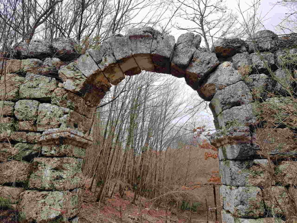
From Trevi nel Lazio, we climb up a mule track through the woods, reaching the Trevi Arch, a magnificent Roman stone arch that once served as a customs post marking the boundary between Roman lands and those of the ancient Italic population of the Equi. Continuing along a trail through wide meadows with grazing animals, we reach Guarcino, the “town of waters,” known for its many fountains supplying excellent mineral water, which is also bottled. The town is also famous for its amaretti, delicious almond paste cookies. The next stop is Vico nel Lazio, surrounded by imposing city walls and often called “the small Carcassonne of Ciociaria.” Finally, we reach Collepardo, the “town of herbs,” due to a centuries-old herbal tradition dating back to the Carthusians. Near the village, there are two interesting geological curiosities: the Pozzo d’Antullo, a karst sinkhole with a circumference of 300 meters and a depth of over 70 meters, and the Grotte dei Bambocci, caves named for their childlike-shaped stalactites, creating a surreal underground world.
Day 13 | Collepardo to Casamari
- Distance: 25km
- Elevation Gain: 680m
- Average Duration: 8-9h
- Difficulty level: Hard
- Start/Finish: Collepardo to Casamari
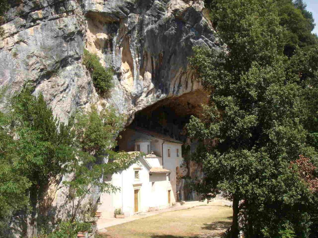
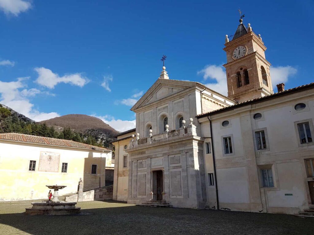
Starting along an uphill Roman road, we walk through a beautiful forest reserve that has housed the Certosa di Trisulti for eight centuries. Built in 1204 by Pope Innocent III, this is a true gem of Carthusian architecture, containing numerous artworks and a charming 17th-century pharmacy. Just below, there is a small sanctuary in a cave, Madonna delle Cese. The day’s destination is the Abbey of Casamari, a magnificent and rare example of “Cistercian Gothic” in Italy. Its church, with its forest of pillars, is breathtaking. A community of monks lives here, practicing hospitality and holding impressive religious services in Gregorian chant.
Day 14 | Casamari to Arpino
- Distance: 22km
- Elevation Gain: 350m
- Average Duration: 6-7h
- Difficulty level: Medium
- Start/Finish: Casamari to Arpino
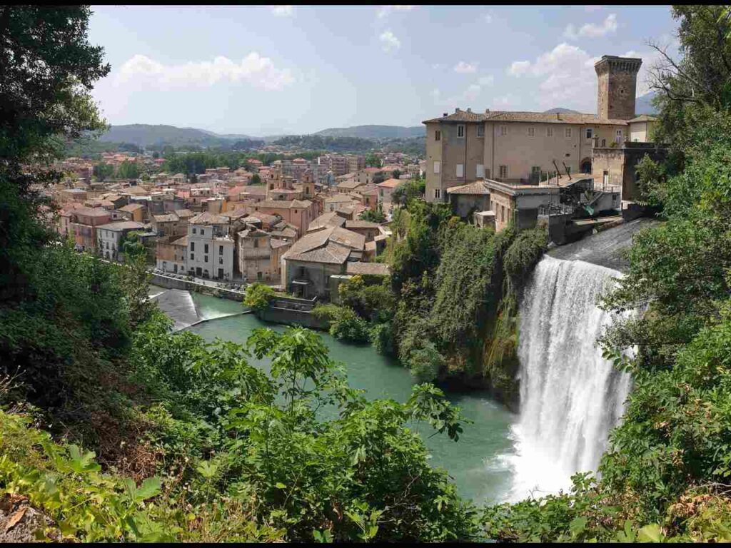
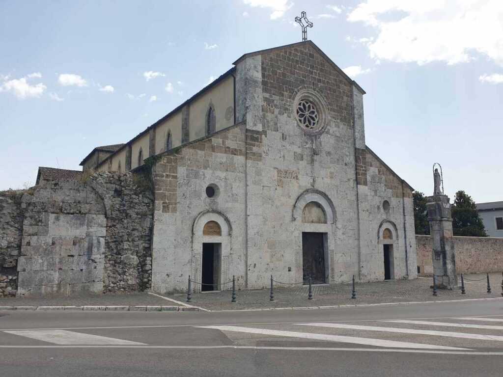
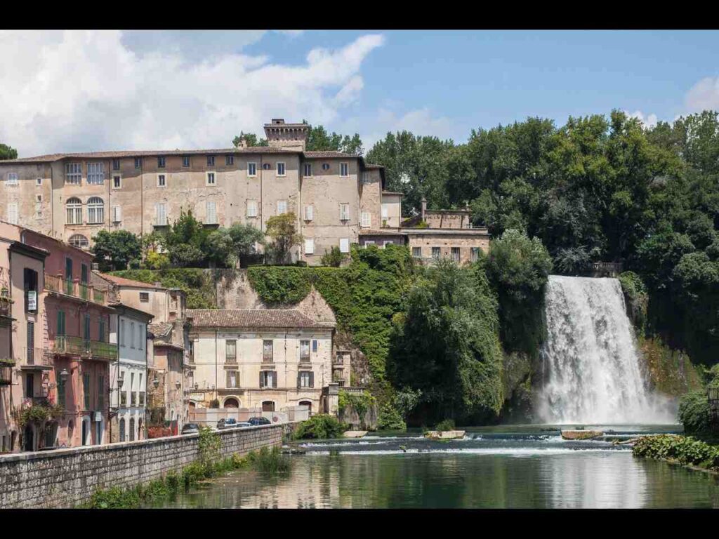
The trail passes through a rather populated area, so it is surprising to find an enormous waterfall in the center of Isola del Liri, towering 30 meters high. The town is charming, and it’s worth stopping to admire this impressive natural spectacle while enjoying a coffee or gelato. For those who wish to reach Arpino quickly, there is a shorter variant that cuts 6 km from the route. Otherwise, the path follows the Liri River to the Abbey of San Domenico in Sora, a wonderful Cistercian complex founded in 1011 by Saint Dominic of Sora on the ruins of the birth villa of the famous orator Cicero. Of particular interest is the crypt, where the Saint is buried. The route continues along the Fibreno River, a tributary of the Liri, and then climbs steadily to Arpino, where a visit to the ancient acropolis of Civitavecchia is a must, to admire the megalithic walls and Italy’s only example of a pointed arch.
Day 15 | Roccasecca to Montecassino
- Distance: 19km
- Elevation Gain: 440m
- Average Duration: 6-7h
- Difficulty level: Medium
- Start/Finish: Roccasecca to Montecassino
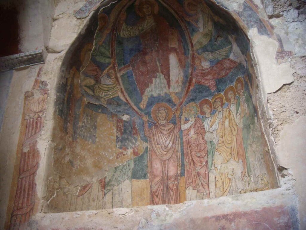
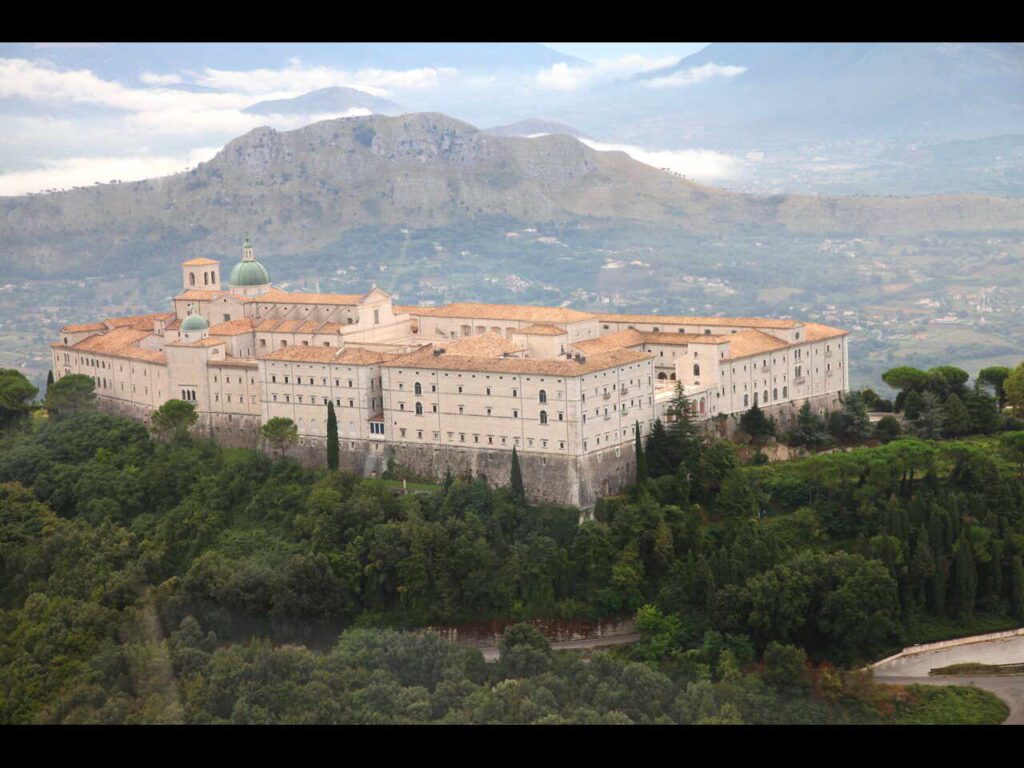
There is only one day left to reach the goal of the pilgrimage: Montecassino. The first part of the route is along secondary paved roads, passing through Caprile, where the Hermitage of Sant’Angelo in Asprano is located, as well as Castrocielo, Piedimonte San Germano, and Villa Santa Lucia. Then, the path continues on a trail, and the sight of the Abbey of Montecassino, in all its grandeur, will be an emotional moment. At the entrance, a large inscription reads: “PAX” (peace), welcoming pilgrims. The journey ends at the main altar of the basilica, where the saint rests alongside his twin sister, Saint Scholastica. All that remains is to say a prayer to the Holy siblings, perhaps hoping to return soon.
Day 16 | Roccasecca to Montecassino
- Distance: 19km
- Elevation Gain: 4500m
- Average Duration: 7h
- Difficulty level: Medium
- Start/Finish: Roccasecca to Montecassino
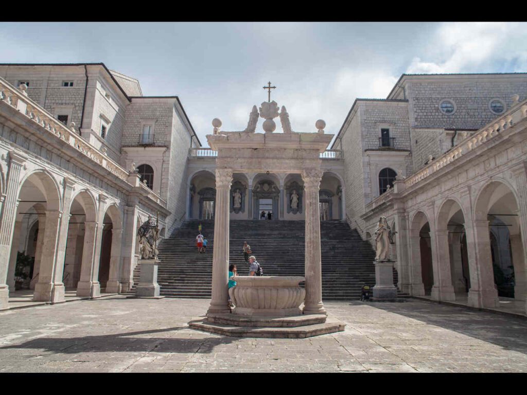
Last day to reach the destination of the Camino: Montecassino. The first part of the route follows secondary paved roads, passing through Caprile, where the hermitage of Sant’Angelo in Asprano is located, as well as Castrocielo, Piedimonte San Germano, and Villa Santa Lucia. Then the journey continues along a trail, and it will be thrilling when, after a turn, the abbey of Montecassino appears in all its majesty. Pilgrims are greeted by a large inscription above the entrance: “PAX,” peace. The route ends at the main altar of the basilica, beneath which the saint rests alongside his twin sister, Saint Scholastica. All that remains is to offer a prayer to the holy siblings—perhaps one to return again soon.
The Cammino di San Benedetto offers the opportunity to discover not only the places central to the experience of Saint Benedict of Norcia, but also lesser-known parts of Italy that are untouched by mass tourism, making them all the more captivating for the attentive traveler. Moreover, this journey fosters human connection, promoting brotherhood and mutual understanding among peoples.
This is especially significant as the pilgrimage ends in Montecassino, a place deeply affected by the events of World War II and today, thanks to the Cammino di San Benedetto, it stands as a place of welcome, spirituality, and peace.
👇🏻Feel free to book a “Discover Italy like a Local” with me 👇🏻
Catch You Outside,
Elena
Frequently Asked Questions
English BOOK GUIDE
The Way of Saint Benedict, third edition Terre di mezzo editore. Buy it here
Dog allowed?
Yes, You can take your puppy… but only if you collect their 💩!!
Where to sleep? Tent?
Along the stages, there are numerous accommodation options, from small family-run commercial structures to “donation-based” hospitality (free offering). All accommodations are listed on the website www.camminodibenedetto.it, and each one includes the agreed-upon prices. There are no equipped campsites along the route, but it is possible to ask agriturismi if you can pitch a tent.
Difficulty
The difficulty varies depending on the stages, but there are no dangerous sections, although more attention is required on mountain trails, such as the descent to Poggio Bustone (stage 4).
Credentials?
You can request the credential from the website https://www.camminodibenedetto.it/credenziale/ to have it sent home before departure, or you can pick it up at the Ostello Capisterium in Norcia.
By presenting the stamped credential upon arrival at Montecassino, you will receive the Testimonium, the document certifying the completion of the pilgrimage.
Best months to hike it?
- Spring to Autumn.
- As usual, check weather forecasts for safety, avoiding the trail during heavy rain or strong winds.
What to bring?
- Wear sturdy, comfortable hiking shoes suitable for various terrains. It is not a walk in the park.
- Carry trekking poles for stability.
Trail waymarking
- Well-Marked trail with signage
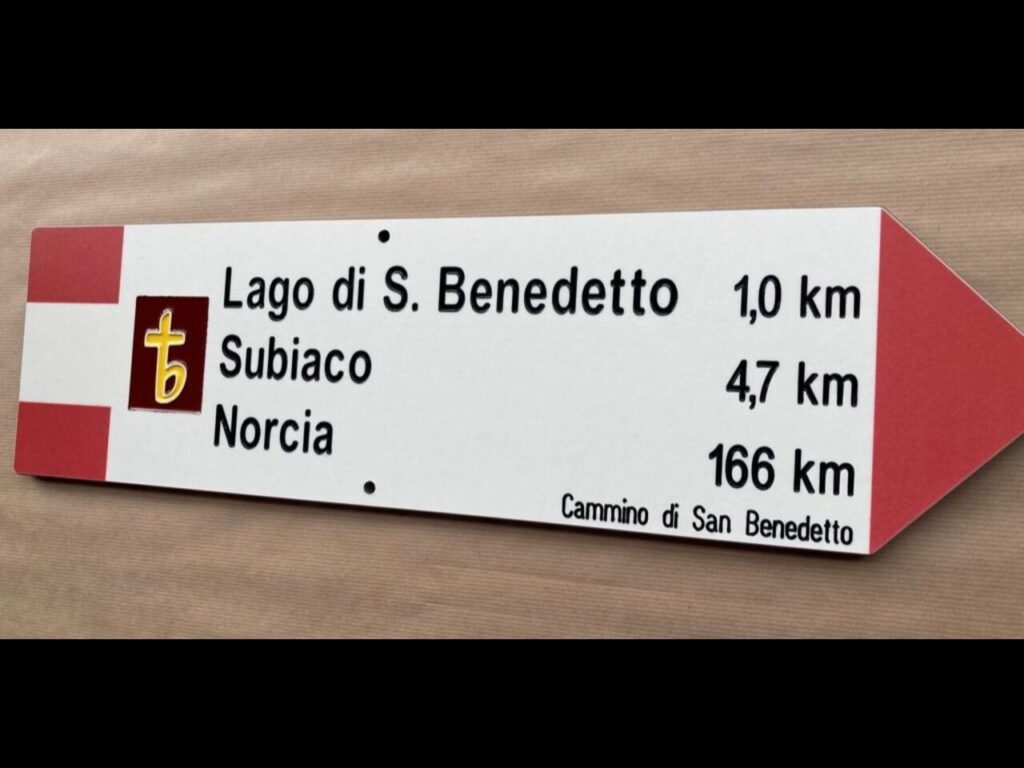
- The signs indicate the next destination, intermediate stops, and the final destination for each stage, along with the corresponding distances in kilometers.
- Especially if you don’t speak Italian, I would recommend having a gpx map with you.
Planning Information
Get the guide and read it carefully, gather information from the website www.camminodibenedetto.it
Getting there & Away
From Rome, take the train to Spoleto and then a bus to Norcia; for the return from Cassino, take the train to Rome.
Permits & Fees
No Permits required.
IMPORTANT: Pay close attention to the data contained in this description.
They may be incomplete or outdated. The paths may change over time due to bad weather, fires or simply the change of seasons. Check in the comments if anyone has made any reports or recommended any changes.
Do you still have a question?
"Discover Italy Like a Local" Consultation
I always try to write everything I can to give the best possible informations, but if you feel like you need a specific and tailored consultation, feel free to book a one-on-one consultation to address your concerns, answer your questions, and provide support throughout the planning process.❤️

